South Geelong's measured centre is about 2.2 km from the Geelong CBD in a straight line, and the main roads in and around it include Fyans Street, Breakwater Road and Barwon Terrace. Emergency Plumber Geelong takes plumbing jobs in South Geelong and across the Geelong region, from the first call to the finish.
Plumbing issues in South Geelong
- The measured centre is 0.2 km from the Barwon River (figures below), which is why the flood-overlay check further down is worth five minutes.
- Mixed housing age within short distances — an original cottage and a 2015 townhouse can be neighbours, and they fail in completely different ways.
South Geelong in brief
South Geelong's measured centre is about 8 m above sea level and 0.2 km from the Barwon River; the ring 250 m out reads 2 to 14 m. Whether one address carries a flood overlay is a planning fact, not a guess, and the VicPlan report answers it (see the question below). For everyday plumbing the useful question is: when a drain is slow, does it happen in dry weather too? A slow line in dry weather points to a blockage on your side. A gully or pit that only holds water while the river or the street drains run high points to a full network, which no clearing on the property fixes.
For costs, see indicative prices; for licences, the Victorian register check.
What we measured in South Geelong
| Ground level at the centre | about 8 m above sea level |
|---|---|
| Height range within 250 m | about 2 to 14 m |
| Nearest sea or bay shore | about 2.4 km |
| Distance to the Barwon River | about 0.2 km |
| Distance to Geelong CBD | about 2.2 km |
| Main roads | Fyans Street, Breakwater Road, Barwon Terrace and Moorabool Street |
| Parks and reserves | Foster Street Reserve, Bob Morell Reserve and Kardinia Park |
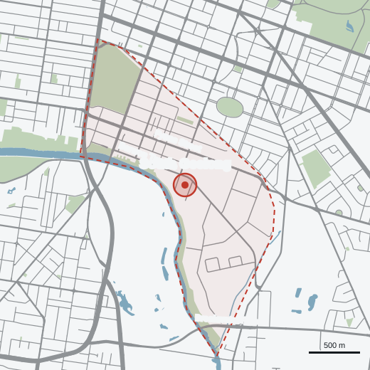
Sources and method: how we measured.
Talk it through
No obligation. Takes 30 seconds.